Where the real limitations are
Resolution and within-farm variability
YES-TECH’s satellite inputs run at moderate resolution (5–30m), which is well suited to Insurance Unit-level aggregation but can’t detect variation within an individual small farm. Localised events – a hail corridor, a flooded pocket, a pest outbreak on part of one field – can get averaged away once results are aggregated to the IU level.
Farmer trust and independent validation
Field experience has been mixed in early rollout. A widely discussed case in Madhya Pradesh’s soybean-growing districts saw dissatisfaction among farmers over claim settlements after YES-TECH was adopted for selected crops, with experts calling for continued independent assessment of accuracy alongside the technology rollout.
Institutional coordination
YES-TECH’s value depends on clean linkage between satellite-derived crop maps, cadastral boundaries, and CCE data collected by state agriculture departments – the same data-integration challenge that shows up across most Digital Agriculture Mission components. Where that linkage is incomplete, reconciliation between satellite and ground estimates becomes harder, not easier.
What states need to operationalise YES-TECH well
Adopting YES-TECH isn’t simply a matter of switching on satellite monitoring for a state’s Insurance Units. States that get consistent, defensible results tend to invest in three things beyond the model itself:
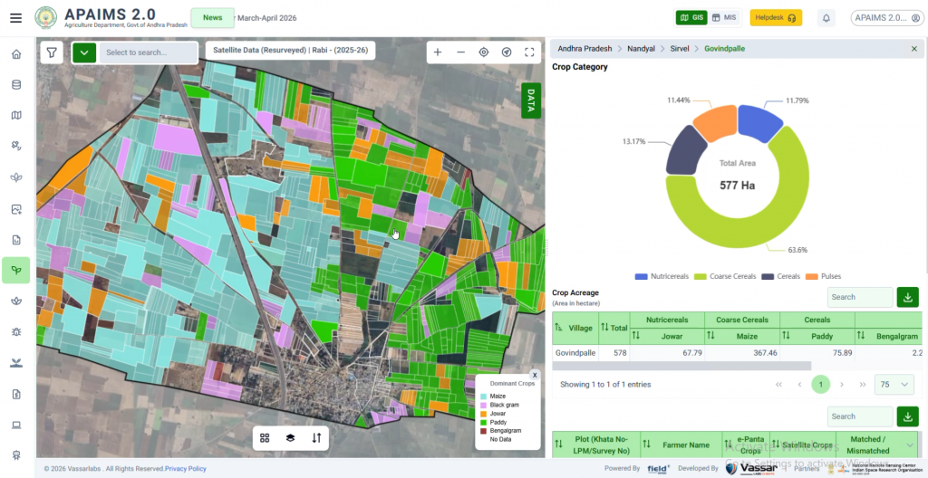
- Crop-type ground truth – the model’s accuracy depends heavily on knowing what crop is actually growing where; this is precisely the gap a well-run Digital Crop Survey closes, and states running both programmes in parallel tend to see fewer classification errors than those running YES-TECH in isolation.
- Local model calibration – a Radiation Use Efficiency model calibrated for one crop and agro-climatic zone doesn’t automatically transfer to a different crop or region; states need either a properly recalibrated model per zone or a clear-eyed view of where accuracy will be weaker.
- A functioning dispute-resolution process – given the Madhya Pradesh experience, states adopting YES-TECH benefit from having a clear, farmer-facing process for challenging a yield estimate, rather than treating the model’s output as unquestionable.
Why this is still considered progress
Experts reviewing the shift have generally converged on a pragmatic view: manual CCEs are theoretically sound but cumbersome, prone to inconsistency, and slow, and technology-based estimation – while imperfect – tends to produce smaller inaccuracies than pure manual sampling once implemented well. The push isn’t to declare YES-TECH perfect, but to keep improving its accuracy while it delivers faster, more transparent claim settlement than the system it’s replacing. That framing – “better than what came before, and still improving” – is a more honest way to evaluate any new agricultural technology than expecting it to be flawless on day one.
How a YES-TECH-based claim actually gets processed
- Season-long monitoring – satellite imagery tracks crop condition and biomass accumulation through the growing season for every Insurance Unit in scope.
- Crop Cutting Experiments conducted – sample harvests are carried out as usual at the end of the season, per standard PMFBY protocol, and uploaded via the CCE-Agri App.
- Blended yield calculated – the satellite-derived estimate and CCE data are combined using the mandated weighting to produce a single Insurance Unit-level yield figure.
- Comparison against the threshold yield – the blended actual yield is compared with the pre-declared threshold yield for that Insurance Unit to determine whether a shortfall, and therefore a claim, exists.
- Payout calculated and processed – once a shortfall is confirmed, claim amounts are calculated and disbursed through the National Crop Insurance Portal.
The specific value YES-TECH adds to this sequence is mostly in steps one and three – continuous season-long monitoring that CCEs alone can’t provide, and a faster, more defensible route to the final blended figure once harvest data comes in.
How this connects to the broader Digital Agriculture Mission
YES-TECH doesn’t operate in isolation. Its accuracy improves directly when it can draw on verified crop-type data from the Digital Crop Survey, rather than having to infer crop type from satellite signatures alone. This is a recurring pattern across India’s digital agriculture programmes: each component’s individual value goes up substantially once it’s integrated with the others, rather than treated as a standalone system.
Frequently asked questions
Is YES-TECH replacing Crop Cutting Experiments entirely?
Not currently. YES-TECH is explicitly designed as a blended approach, with a mandated minority weighting for satellite-derived yield alongside CCE data, rather than a full replacement of manual sampling.
Which crops does YES-TECH currently cover?
Coverage has expanded progressively since piloting began, focused on major crops where satellite classification is well established; specific crop and state coverage should be verified against current PMFBY documentation, as this continues to expand.
How accurate is YES-TECH compared to manual estimation?
Accuracy varies by crop, region, and season. Independent studies and field experience suggest technology-based estimation is generally more consistent than manual sampling at scale, though specific disputes – such as those reported in parts of Madhya Pradesh – show accuracy is not yet uniform everywhere.
What is the WINDS portal and how does it relate to YES-TECH?
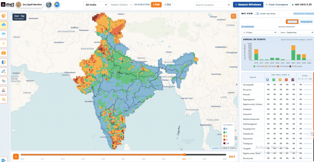
The WINDS portal centralises hyperlocal weather data from Automatic Weather Stations and rain gauges at the taluk and Gram Panchayat level. YES-TECH’s yield model draws on this weather data alongside satellite imagery, making WINDS a foundational input rather than a separate, unrelated system.
Does YES-TECH work equally well for every crop?
No. Crops with distinctive, easily classified canopy signatures at moderate satellite resolution – like wheat or rice – tend to model more reliably than crops with more variable planting patterns or shorter, less distinct growth stages. This is part of why rollout has proceeded crop by crop and state by state, rather than as a single nationwide switch.
Yield models are only as good as the data feeding themfieldWISE integrates satellite yield models like YES-TECH with verified crop registry and weather data – so the estimate a state relies on is built on the clearest possible picture of the field. → See how fieldWISE handles yield estimation |
Further reading
Government of India, PIB – Technological Advancements in Crop Insurance (YES-TECH & WINDS Portal): https://www.pib.gov.in/PressReleaseIframePage.aspx?PRID=1941597
Related on this blog: What Is the Digital Crop Survey (DCS)? · Precision Agriculture Explained