Bringing a scientific approach to assessing watershed health ensures efficient site selection for water and soil conservation, recharge, and creating a sustainable master plan considering existing water needs and the impact of climate change scenarios.
Integrated decision support system that helps public policy planners, administrators, field officials, NGOs and citizens to plan their watershed activities more scientifically, to maximize the impact of water conservation activity
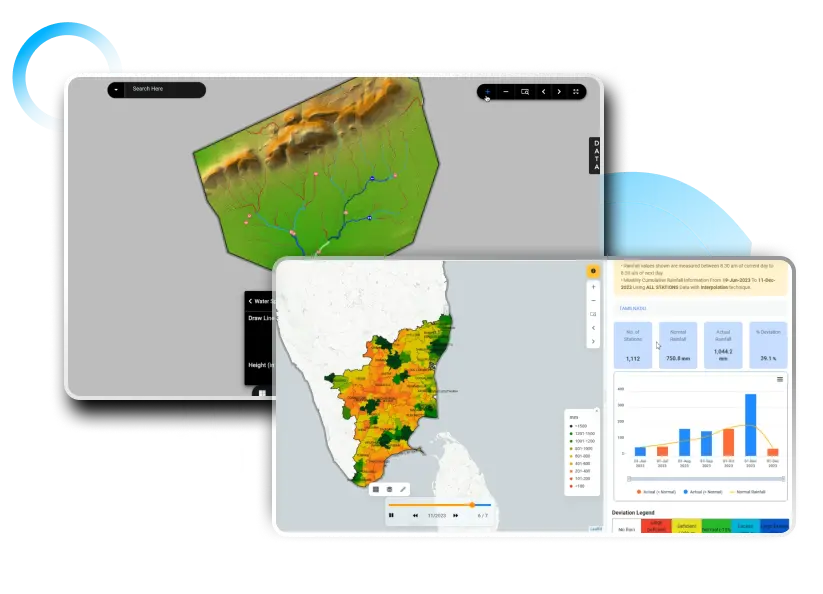
Single Window Database
One authoritative database for all watershed related data and activities. water supply, water Demand, runoff, geo-spatial data, satellite data, weather, works, funds, master plans etc.
Hydrology and AI Models
The system will compute/estimate runoff, Identify catchment zones, conservation sites and reliability. Get Analytics on available data for 30 years to estimate the reliability and make recommendations.
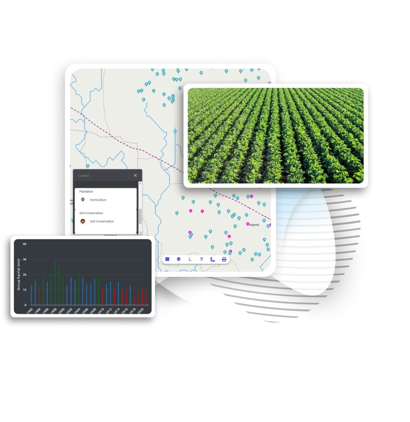
Master Plan Preparation
Preparation of watershed level soil conservation, water conservation and plantation masterplans. Prediction on potential locations and 3D structure analysis based on suitable zones enables better water security planning
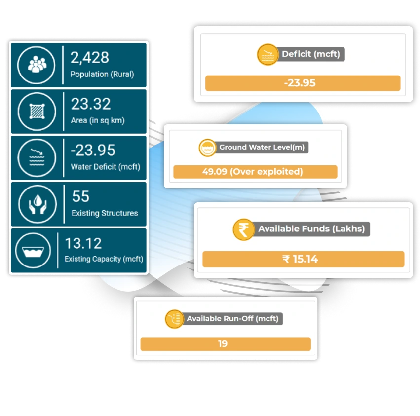
Village Water Budget
Platform uses various models to identify surplus and deficit villages. Amount of run-off conserved and excess based on a network model that considers all the water conservation structures in that area.
Plug and Play Modules Powered by aquaWISE
Get Accurate Insights from Satellite Imagery, Machine learning predictive models and weather data to take right decisions at right time
Catchment Area Treatment Plan
Prediction of suitable locations for soil conservation structure, water conservation structure and plantation work, based on site suitability and hydrological assessment
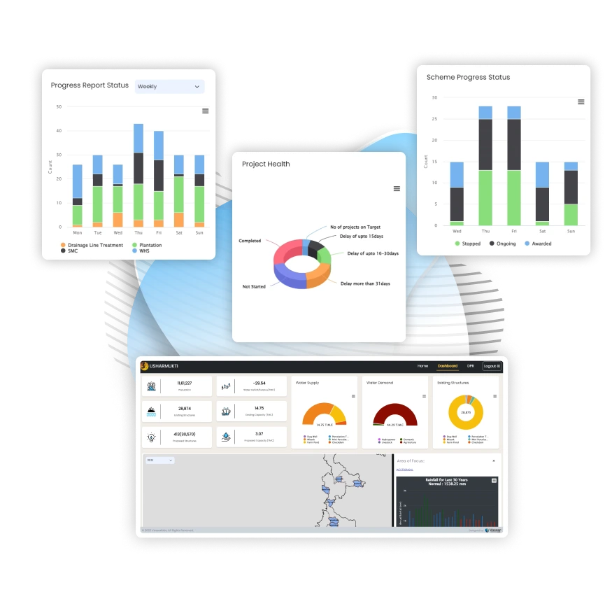
Project Progress Monitoring
Mobile and Web GIS MIS based dashboard to track the progress of the watershed activities. Digital workflow improves transparency in decision making
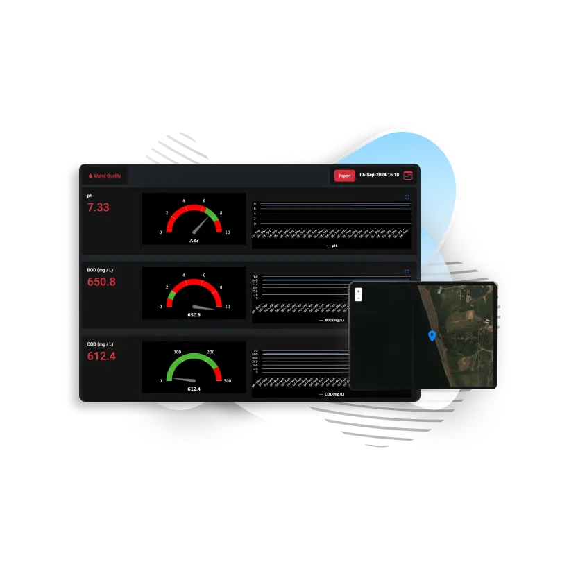
Mobile Application
Facilitate field validation and data capture through e-workflow. Geotagging leverages field level validation increasing efficiency in watershed management
User Friendly
Accessible on cloud, easy navigation, user specific interactive dashboard which provides decision support and dissemination of information.
Know More About aquaSHED
Explore Climate technology solution with Vassar Labs – Pioneers in technology platform for effecient water managemnet, precision agriculture, smart city services, energy and disaster