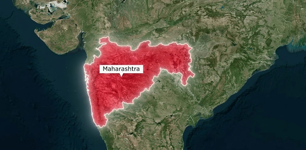
In the heart of India’s agricultural landscape, Maharashtra stands at a crossroads. As the state grapples with fragmented landholdings, disputed boundaries, and the urgent need for precise land records, a technological revolution is quietly transforming how we see and manage farmland. MahaAgriNEX has successfully digitized farm boundaries across 26 districts of Maharashtra, creating over 100 million farm polygons with greater than 90% accuracy – a feat that would have taken decades through traditional manual surveys.
It’s about building the foundational layer of Digital Public Infrastructure that enables everything from direct benefit transfers to crop insurance, from irrigation planning to climate resilience. It’s about giving every farmer in Maharashtra a verified digital identity for their land.
The Challenge: Maharashtra’s Complex Agricultural Landscape
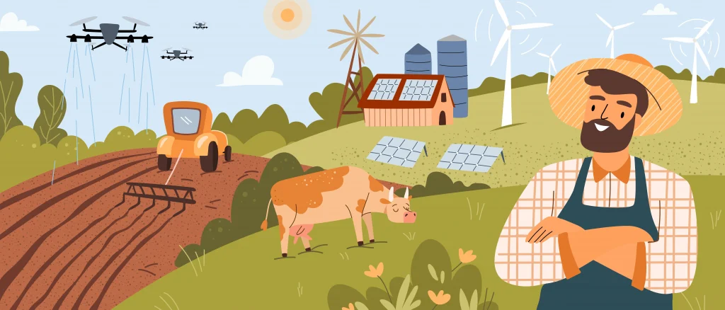
Maharashtra agriculture operates at an unprecedented scale of complexity. With over 12.5 million cultivators working across diverse agro-climatic zones, from the cotton fields of Vidarbha to the sugarcane belts of Western Maharashtra, the state faces unique challenges that have historically hindered effective agricultural governance.
Land fragmentation stands as one of the most persistent challenges. Research from Vidarbha documents how inheritance practices have created a cascading problem: what was once four consolidated one-acre fields gets divided among four sons, creating sixteen separate fragments scattered across village boundaries. Between 2010-11 and 2015-16 alone, Maharashtra witnessed an 11.58% increase in operational holdings, accelerating this fragmentation trend.
The consequences are severe. Farmers waste time moving equipment between scattered plots. Boundary disputes lead to expensive litigation. The proportion of land lost to boundary markings increases as plots shrink, reducing actual cultivable area. Mechanization becomes economically unfeasible when fixed equipment costs cannot be justified across such small, fragmented areas.
Traditional land record systems haven’t kept pace. Despite initiatives like the Digital India Land Records Modernisation Programme (DILRMP), the scanning process for tehsils, land records, and city land survey offices in 35 districts has faced delays. Manual surveys are slow, expensive, and prone to errors. Disputed boundaries delay scheme implementation. Farmers struggle to access credit because financial institutions cannot verify exact landholdings.
The Solution: AI-Powered Precision
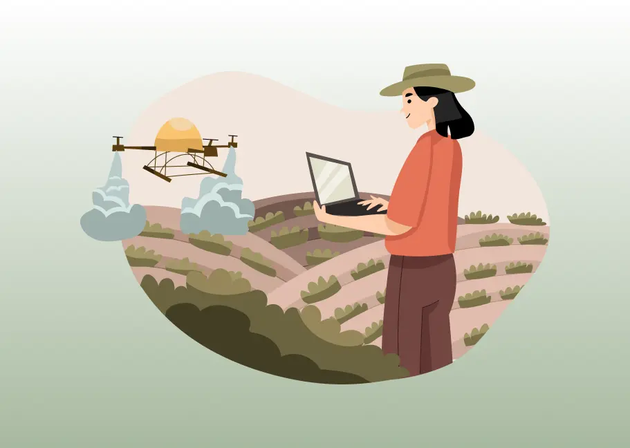
fieldWISE’s approach to farm boundary detection represents the convergence of artificial intelligence, satellite remote sensing, and agricultural domain expertise. Unlike traditional survey methods that require physical ground visits to every field, this AI-powered approach works from space, processing high-resolution satellite imagery to automatically identify and map the raised earthen boundaries – bunds – that separate agricultural plots across India.
At its core, the system uses deep learning algorithms trained on thousands of manually verified farm boundaries from Maharashtra’s diverse agricultural landscapes. These algorithms learn to recognize the visual signatures of farm bunds, distinguishing them from roads, water bodies, settlements, and vegetation with remarkable precision.
The process operates through several key stages:
- Intelligent Image Processing: High-resolution satellite imagery is acquired and processed across target areas. The system handles massive geospatial datasets efficiently, processing entire districts while maintaining consistent quality.
- Automated Boundary Recognition: Trained AI models analyze satellite imagery grid by grid, identifying farm boundaries and converting them into precise geometric polygons that align perfectly with official coordinate systems.
- Human-Verified Quality: Generated boundaries appear on interactive web maps where agricultural officers can verify, edit, merge, or refine polygons as needed.
Seamless Integration: Through open APIs, the system integrates with existing government databases – land records, farmer registries, scheme management platforms – ensuring farm boundaries flow into downstream applications without manual data entry.
What makes this system truly powerful is its combination of automation and accessibility. The dashboard requires no programming knowledge. Agricultural officers familiar with basic geospatial concepts can manage the entire workflow through an intuitive interface. Pre-trained models allow immediate deployment, while the option to train custom models using local ground truth data ensures the system adapts to regional variations in field patterns and land use.
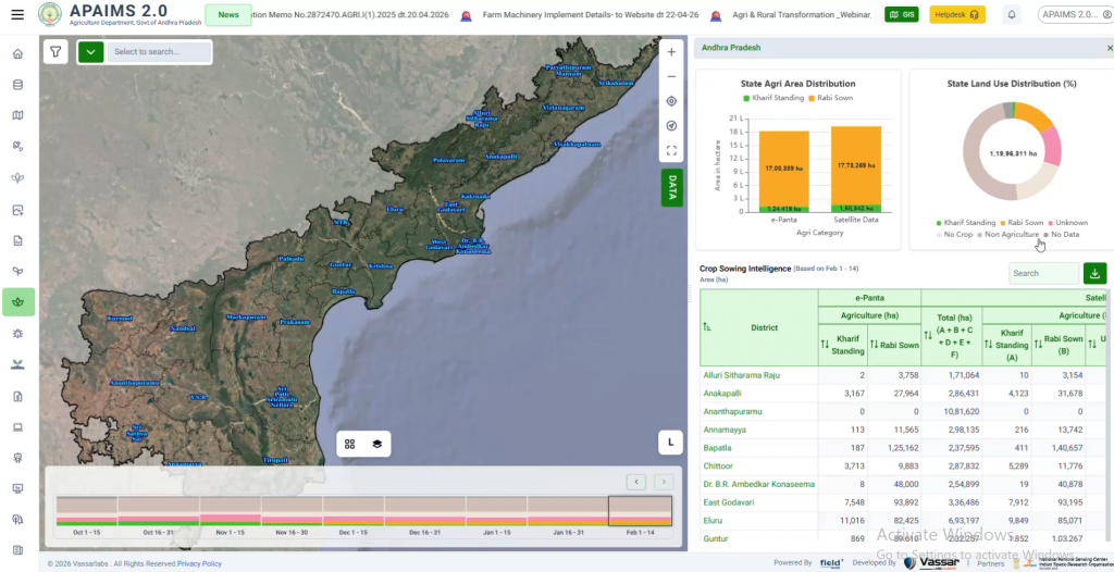
Maharashtra Deployment: 100 Million Farm Boundaries at 90%+ Accuracy
The numbers tell a remarkable story. Across 36 districts of Maharashtra, MahaAgriNEX has generated over 100 million farm boundary polygons (10 crore bunds), covering all 44,794 villages in the state.
Accuracy exceeds 90% in the majority of districts – a threshold that makes these boundaries usable for critical applications like Direct Benefit Transfers, crop insurance verification, and input subsidy distribution. This level of precision would be impossible through manual surveys at this scale within any reasonable timeframe or budget.
Empowering State Machinery: No-Code Platform for Ground-Level Officers
One of MahaAgrNEX’s most transformative aspects is democratizing advanced AI technology for government officers at all levels. The bund boundary detection module requires no programming knowledge or AI expertise. Department officials – from interns to GIS experts – are actively using the intuitive dashboard to generate farm boundaries, verify outputs, and even retrain new models for their specific regions.
This no-code approach has fundamentally shifted the implementation model. Agricultural officers can independently initiate boundary detection for their districts, review and edit generated polygons using simple map-based tools, upload ground truth data to improve model accuracy, and deploy retrained models – all through a browser interface.
This capability transfer has enabled Maharashtra’s state machinery to take ownership of the digitization process rather than remaining dependent on external technical teams. Officers understand their regions’ unique agricultural patterns – intercropping systems, irregular field shapes, seasonal variations – and can now incorporate that local knowledge directly into the AI training process. The result: continuously improving accuracy, faster deployment across new districts, and a skilled cadre of government officers who can sustain and expand the digital infrastructure independently. True Digital Public Infrastructure doesn’t just provide technology – it builds local capacity to manage and evolve that technology, ensuring long-term sustainability beyond any single project timeline.
From Data to Impact: Real-World Applications
The true measure of Digital Public Infrastructure isn’t the technology itself – it’s the impact it enables. In Maharashtra, digitized farm boundaries have unlocked multiple transformative use cases:
1. Precision Scheme Targeting and Direct Benefit Transfers
With precise boundaries linked to verified farmer identities through Aadhaar, government schemes can now target benefits with unprecedented accuracy. No more reliance on self-reported land areas or outdated records. Officers can see exactly which farms qualify for which schemes based on actual cultivated area, crop type, and location.
This eliminates both inclusion errors (benefits going to ineligible recipients) and exclusion errors (eligible farmers missing out). For subsidy programs tied to land area – fertilizer subsidies, seed distribution, equipment grants- accurate boundaries ensure fair allocation based on actual need.
The administrative efficiency gains are substantial. What previously required field visits to verify each beneficiary’s landholding can now be validated digitally in minutes. This accelerates scheme rollout and reduces the administrative burden on both farmers and officers.
2. Revolutionizing Crop Insurance
Crop insurance in India has long struggled with a fundamental problem: verifying what’s actually planted where. Inaccurate enrollments – whether due to honest mistakes or deliberate fraud – undermine the entire system, raising premiums for honest farmers while draining insurer and government resources.
Digitized farm boundaries combined with satellite-based crop monitoring have transformed insurance verification. The system can now validate enrolled parcels automatically, identifying non-agricultural land incorrectly registered as cropland.
Beyond fraud detection, accurate boundaries enable more sophisticated insurance products. Area-based insurance can be calculated precisely. Crop-specific coverage can be tailored to actual planted areas. Claims can be settled faster using satellite-based damage assessment rather than waiting for manual field verification.
3. Precision Agriculture Advisory at Scale
Generic agricultural advice – “apply X kg of fertilizer per acre” – ignores the reality that every farm is different. Soil varies, water availability differs, microclimates create local variation. Farmers need advice specific to their exact plot.
Digitized farm boundaries make this possible at state scale. With each farm’s location, size, and geometry precisely known, the system can deliver:
Plot-Specific Irrigation Scheduling: Using satellite data on soil moisture, weather forecasts, and crop water requirements, the system calculates optimal irrigation timing for each farm. In water-scarce regions, this precision prevents waste while ensuring crops get adequate water during critical growth stages.
Customized Fertilizer Recommendations: Integrated with Soil Health Card data, the system provides farm-specific nutrient recommendations.
Pest and Disease Forewarning: Weather patterns and crop growth stages create windows of vulnerability to specific pests. With farm locations and crop types known, the system can send targeted alerts: “Your cotton field is entering the stage vulnerable to bollworm – monitor closely and be prepared to intervene.”
Sowing Date Advisory: Based on monsoon forecasts, soil moisture, and local climate patterns, farmers receive optimal sowing windows specific to their location and chosen crop – maximizing germination success and reducing replanting costs.
This personalization transforms agricultural extension from a one-size-fits-all broadcast model to precision guidance at individual farm level – delivered via mobile apps, WhatsApp, and voice in local languages.
4. Irrigation Planning and Water Management
Maharashtra faces chronic water stress, making efficient irrigation planning critical. Digitized farm boundaries provide the foundational data layer for precision water management.
Command Area Optimization: Knowing exact farm locations and sizes within irrigation command areas enables engineers to design optimal canal routes, estimate water requirements accurately, and plan equitable distribution.
Micro-Irrigation Targeting: Government programs promoting drip and sprinkler irrigation can identify and target farms where these technologies offer maximum impact – water-stressed regions, high-value crops, optimal field sizes for economical installation.
Groundwater Monitoring: Overlaying farm boundaries with groundwater level data reveals which farms face acute water stress, enabling targeted interventions like bore well recharge programs or crop diversification incentives toward less water-intensive options.
Drought Response: During drought years, knowing which farms are irrigated versus rainfed enables targeted relief – prioritizing rainfed areas for emergency water supply while irrigated areas receive different support.
5. Environmental Monitoring and Climate Resilience
Digitized farm boundaries create a powerful framework for environmental monitoring and climate adaptation planning.
Land Use Change Detection: By comparing current satellite imagery against historical baselines, the system detects land use changes – agricultural land converted to settlements, forest encroachment, wetland loss. This enables enforcement of land use regulations and environmental protection.
Carbon Sequestration Measurement: As carbon markets develop, accurate farm boundaries enable measurement of carbon sequestration from agricultural practices like agroforestry, conservation tillage, or organic farming – potentially opening new revenue streams for farmers adopting climate-smart practices.
Climate Vulnerability Mapping: Overlaying farm boundaries with climate data – rainfall variability, temperature extremes, flood risk zones – identifies which farms face highest climate risks, enabling targeted resilience interventions like crop insurance, alternate crop promotion, or water harvesting infrastructure.
Stubble Burning Monitoring: In regions where crop residue burning is a concern, satellite monitoring can identify specific farms where burning occurs, enabling targeted awareness campaigns and promotion of alternatives like in-situ residue management.
6. Agricultural Credit and Financial Inclusion
Access to formal credit remains a barrier for many smallholder farmers. Banks require collateral verification, but vague land records create uncertainty. Digitized farm boundaries address this directly.
Instant Collateral Verification: When a farmer applies for a loan, the bank can verify their landholding digitally – seeing exact area, location, crop type, and any existing liens or encumbrances. This reduces processing time and fraud risk significantly.
Risk-Based Lending: Lenders can assess loan risk more accurately. A farm in a chronically drought-prone area might receive drought-resistant crop loans or crop insurance bundling.
Expanding Credit Access: As verification becomes easier and more reliable, banks can extend credit to regions and farmer segments previously considered too risky due to data uncertainty. This financial inclusion unlocks agricultural investments – better seeds, drip irrigation, farm machinery – that increase productivity and incomes.
Conclusion: Digital Foundations for Agricultural Transformation
Maharashtra’s achievement – 100 million farm boundaries mapped with 90%+ accuracy across 26 districts – represents more than technological success. It demonstrates that building true Digital Public Infrastructure for agriculture is not only possible but practical, scalable, and transformative.
This infrastructure now serves as the foundation for multiple government initiatives, enabling targeted scheme delivery, fraud prevention, precise input planning, and data-driven decision-making. It has transformed abstract policy goals – financial inclusion, climate resilience, farmer empowerment – into concrete, measurable outcomes.
The lesson from Maharashtra is clear: agricultural transformation begins with accurate, comprehensive farm-level data. Without knowing where farms are, how large they are, and who owns them, even the best-intentioned policies cannot reach their intended beneficiaries with precision and accountability.
As other states and countries grapple with similar challenges – fragmented landholdings, inaccurate records, inefficient service delivery – Maharashtra’s deployment offers a proven template. The technology works. The process is scalable. The impact is measurable.
The question is no longer whether AI-powered farm boundary detection is possible at state scale. Maharashtra has answered that definitively. The question now is: how quickly can this Digital Public Infrastructure be deployed across India and beyond, unlocking agricultural transformation for hundreds of millions of farmers who need it most?
At Vassar Labs, we’re committed to making that vision reality.