
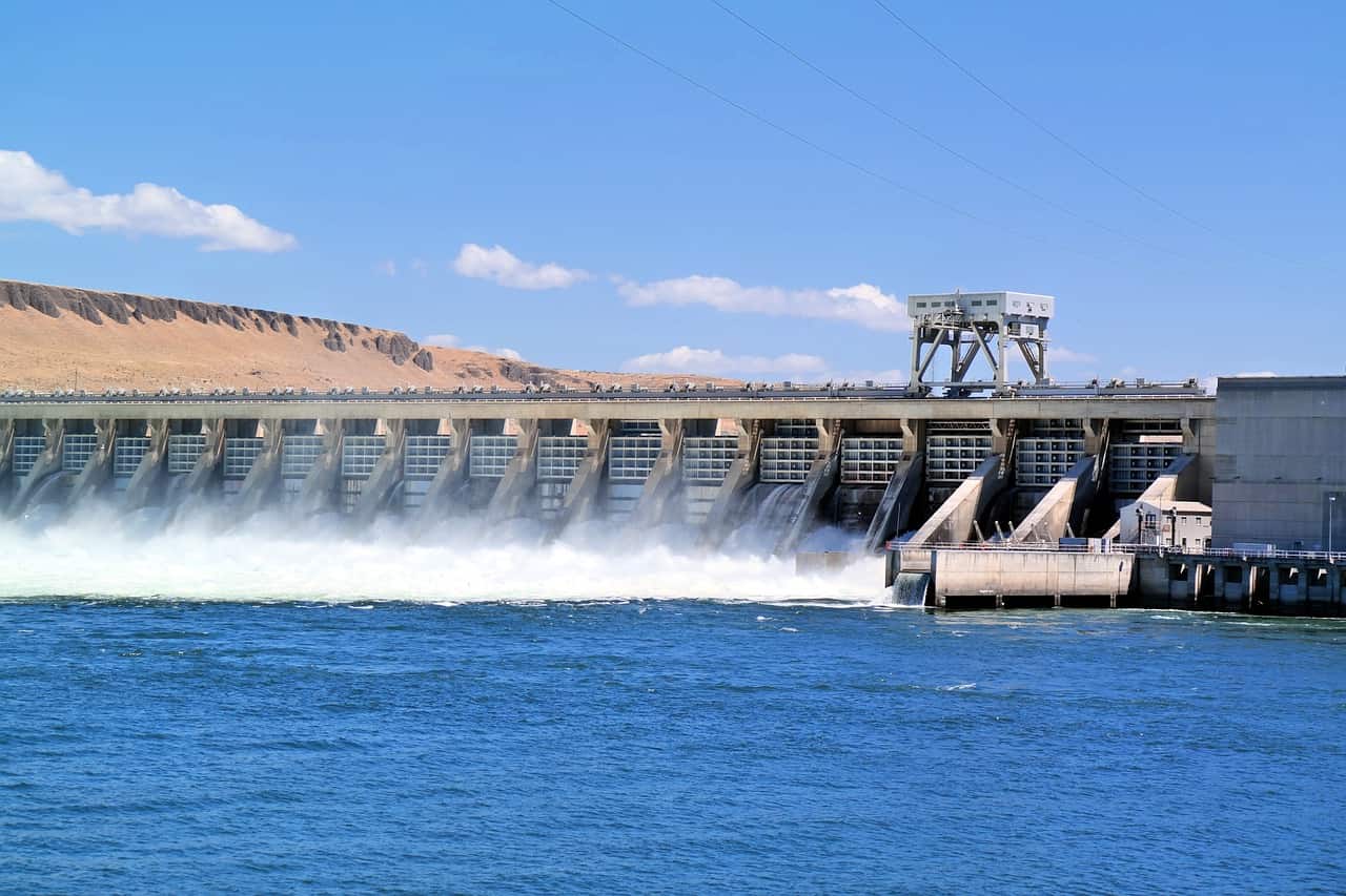


From Reactive to Proactive: Ways to Redefine Flood Management in Cities
Explore how cities can move from reactive flood management to proactive one by leveraging


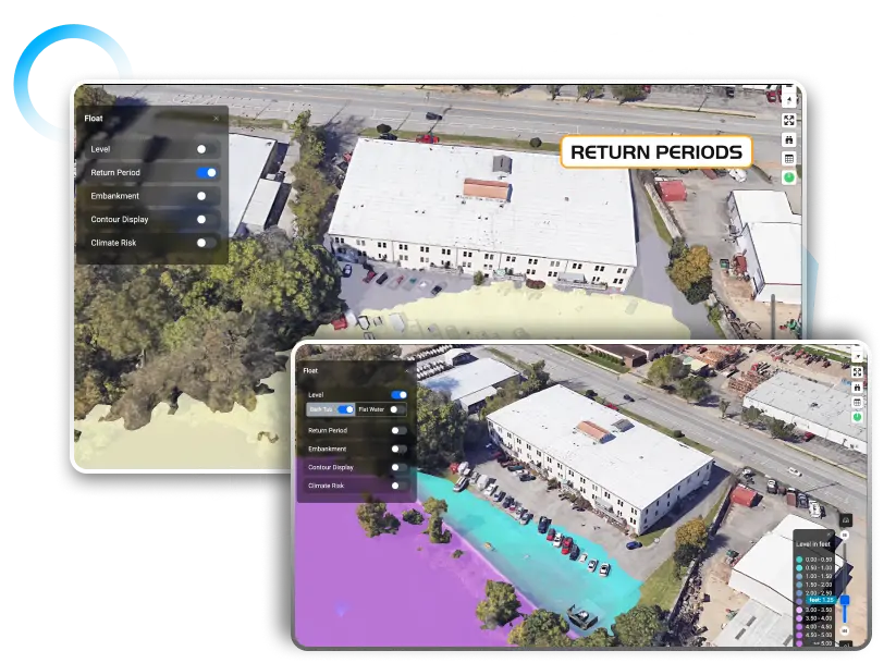
Explore how cities can move from reactive flood management to proactive one by leveraging
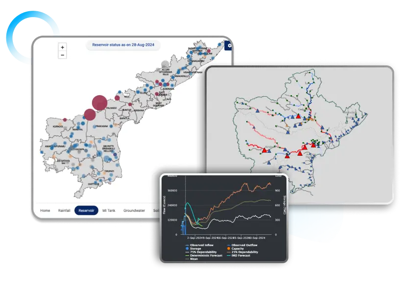
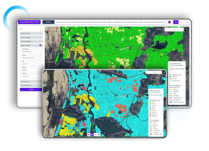
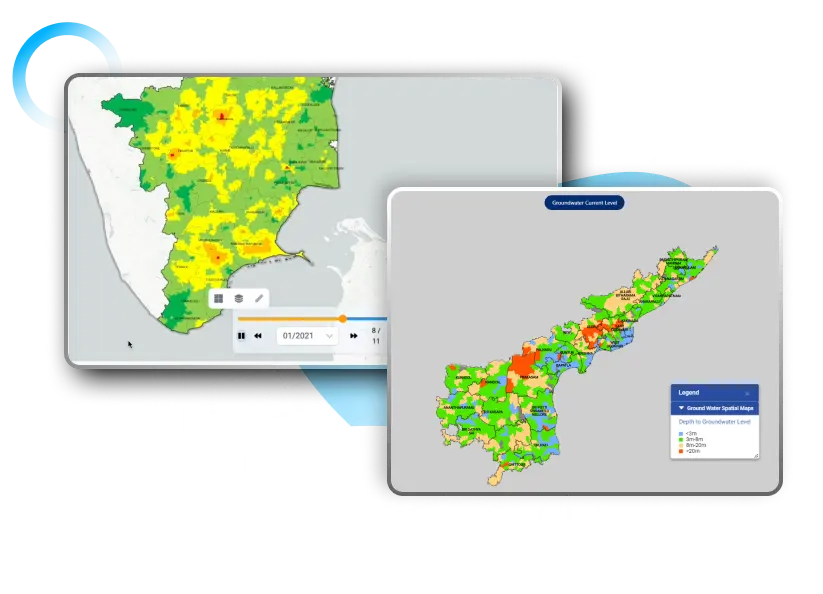
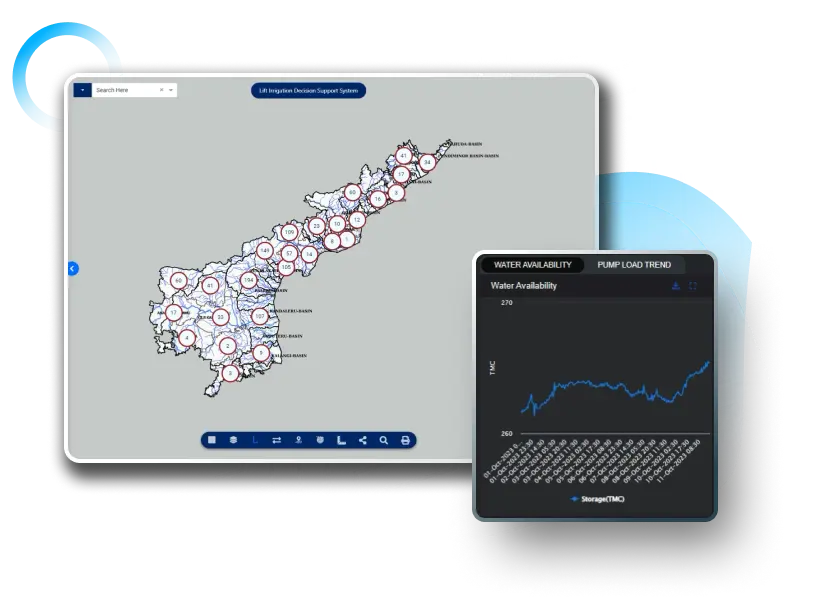
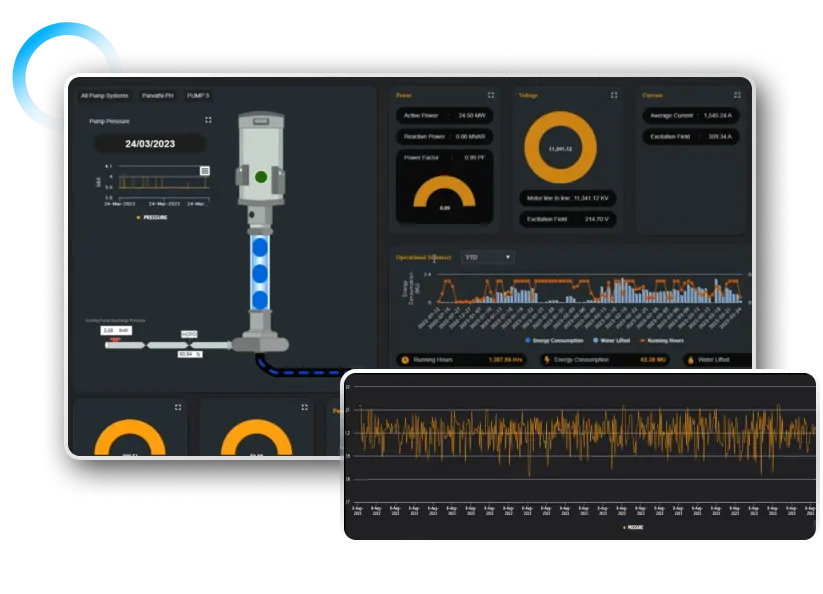
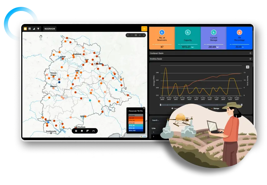
Discover how APAIMS 2.0, powered by VISTAAR and Vassar Labs, is transforming agriculture with

Discover how climate tech startups are using AI, IoT, and satellite analytics to power

Discover how AI-driven piped irrigation systems can reduce water waste, improve agricultural efficiency, and

Discover how AI-powered irrigation solutions like aquaIRRIGATION help farmers reduce water waste, improve yields,