
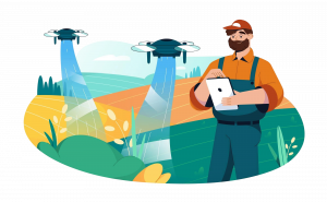
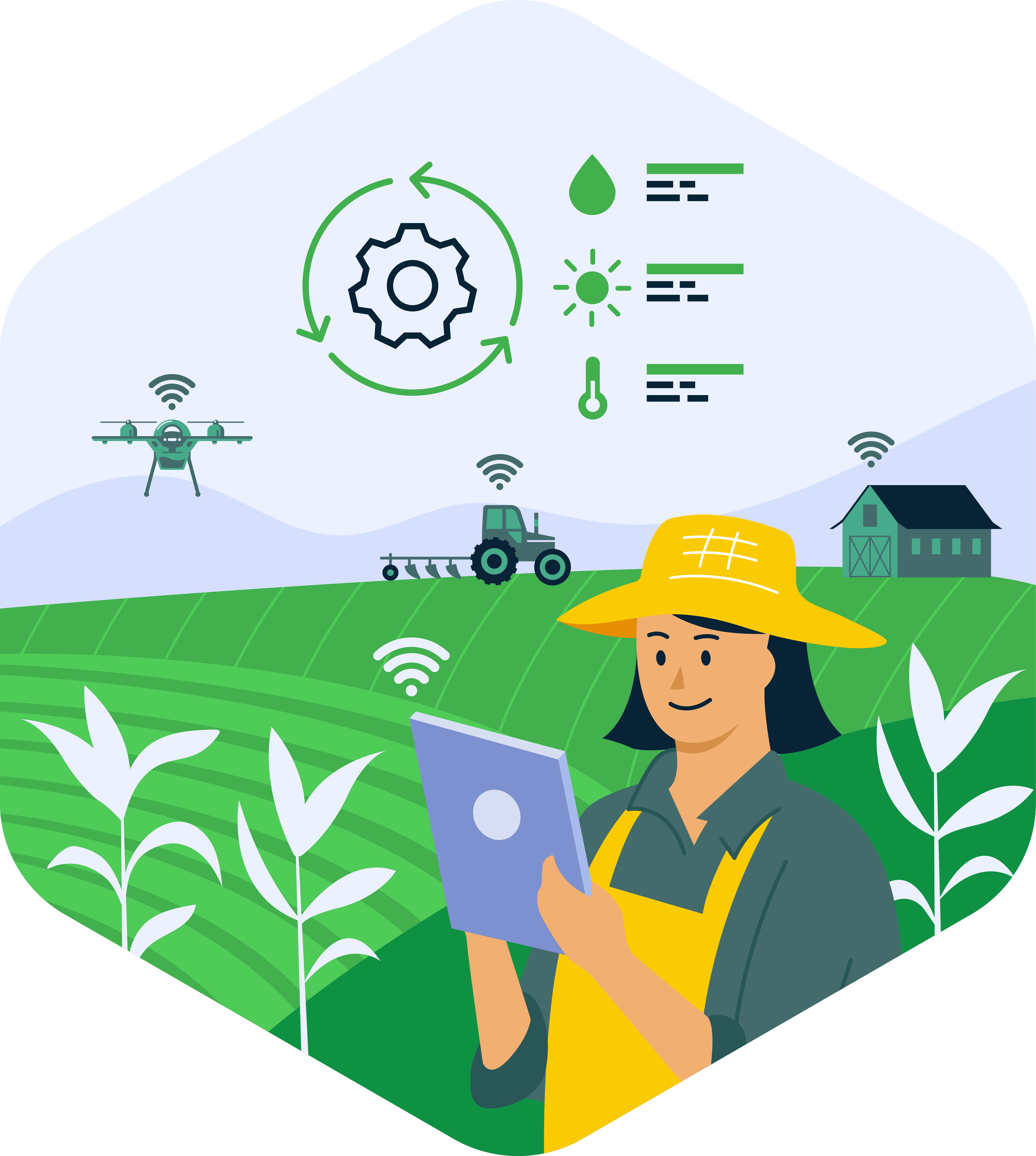
DPI in Agriculture: A New Blueprint for High-Precision Farming Services
Discover how Agriculture DPI and AI deliver verifiable, high-precision services for crop optimization. Essential
aquaWISE is a web-enabled platform offering digital products for water resource monitoring, planning, and management, from small facilities to large geographies. It integrates data from sensors, satellites, drones, and more to create AI-driven digital twins of water systems, ensuring sustainable water management.
aquaWISE is a powerful digital water management platform for all and is packaged into versions to fit the diverse needs of the user groups and geographical scale. It’s ideal for sectors needing high data integration, real-time processing, spatial analysis, and mobile access like smart city management, natural resource management, disaster response, environmental monitoring, and urban planning.
Perfect for small organizations, it provides core features including user-role management, mobile access, and data integration for efficient water management.
Built over the Essential Version, enhanced for medium-sized enterprises with additional tools like a query builder, dynamic data management, e-library, and IoT engine for detailed data insights and spatial analysis.
A comprehensive suite for large enterprises and governmental organizations, featuring a 3D engine, model manager, remote sensing, and Gen AI Suite for extensive, scalable water management solutions.
Manages authentication and authorization ensuring access control based on location, organizational policies, and user responsibilities. It is essential for maintaining data security and integrity.
Provides a user-friendly and intuitive interface for users, compatible with various devices – Tabs, mobiles, and desktops, to seamlessly interact with the platform. It facilitates the data and information presentation in an actionable format and supports user interactions like data queries, visualization, and reporting.
Provides cloud-agnostic integration that delivers scalable data storage, and efficient processing. It ensures enhanced performance and reliable data handling.
Empowers users with the ability to access the platform on mobile devices online or offline, through lite-data allowing users to geo-tag and geo-fence with limited uncertainty.
Keeping the user on top of all real-time updates through various channels like push notifications, messages, and email alerts. Users can also configure communication protocols tailored to different use cases.
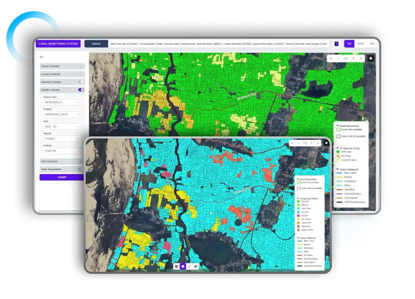
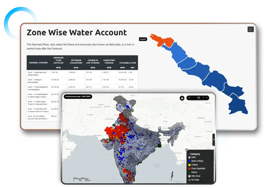
The GIS engine enables advanced geo-spatial analytics for both VECTOR and RASTER data, allowing users to create, modify, and update maps with ease. Additionally, it supports a wide range of geometric operations, including interpolation, topological analysis, spatial analysis, geostatistical analysis, clustering, and regression, and it can publish maps in web-mapping service formats.
It offers seamless data integration and advanced analytics supporting comprehensive data processing capabilities, including batch processing of large volumes, real-time processing, and automated workflows. The data storage section features a versatile data lake capable of storing structured, semi-structured, and unstructured data. Additionally, it provides robust data governance and security measures.
Stores and manages spatial data for analysis and visualization of geographic features, supporting spatial data types, indexing, and queries. It integrates with GIS software and supports versioning, replication, multi-user editing, collaboration, and data sharing for efficient, collaborative workflows.
It is a distributed database with a highly scalable, fault-tolerant, and decentralized architecture. It offers a flexible schema, multi-data center replication, and handles real-time large-scale data across multiple nodes with highly efficient data retrieval and storage mechanisms. It also ensures balanced data distribution and allows easy node addition to the cluster with zero downtime.
It provides a graphical interface where users can select tables, fields, and conditions to construct queries visually, making it easier for those with non-technical backgrounds to retrieve, update, or manipulate data from the database efficiently. It includes features like drag-and-drop functionality, automatic syntax generation, and real-time query results, enhancing user productivity and accuracy in database interactions.
It manages and automates business processes and workflows, streamlining operations with tools and functionalities. It defines task sequences, decision points, and conditional logic, automating repetitive tasks. It sends notifications, alerts on deadlines, and priority issues, offering real-time visibility, monitoring progress, identifying bottlenecks, and providing an audit trail for transparency and accountability.
It gathers IoT data from various frequencies, including SCADA, satellites, crowdsourcing, third-party systems, APIs, and web-scrapers. This integration offers a broad and real-time view, using diverse data sources to improve analysis and decision-making.
A centralized platform for storing and accessing diverse documents, reports, research papers, water- laws, regulations, case studies, and literature on water resources. It eliminates physical storage, reduces printing costs, and allows field personnel to access resources on-site, enhancing flexibility and information sharing across departments.
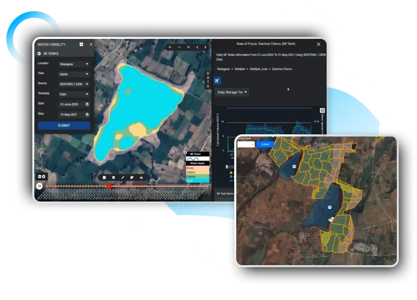
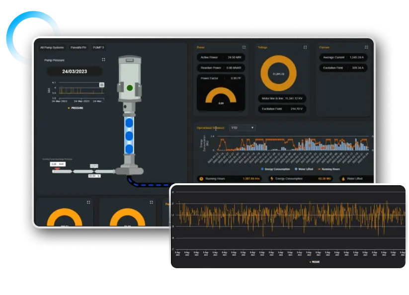
Enabled to connect with various IoT sensors installed across vast geographies to process real-time water management data such as water level, flow, storage, quality, precipitation, and other weather parameters. It also facilitates trend analysis and pattern recognition to detect abnormalities in these parameters.
A sandbox is a secure, isolated environment for testing software and applications without impacting the main system. It allows safe experimentation, debugging, and analysis of new or untrusted code, enabling users to extract user-desired data from existing systems and create scripts for executing various tasks efficiently.
Our 3D engine provides a graphics environment to view flood inundation risks for facilities and properties in a three-dimensional visualized mode allowing users to assess and analyze flood risk with immersive and accurate visual representations.
It prioritizes collaboration, allowing teams to work simultaneously on creating, managing, and analyzing models. It supports AI/ML, hydrological, hydraulic, optimization, crop growth, demand, statistical, and stochastic models, enabling sharing and exporting of results. This tool streamlines diverse models’ development, deployment, and maintenance in a unified environment.
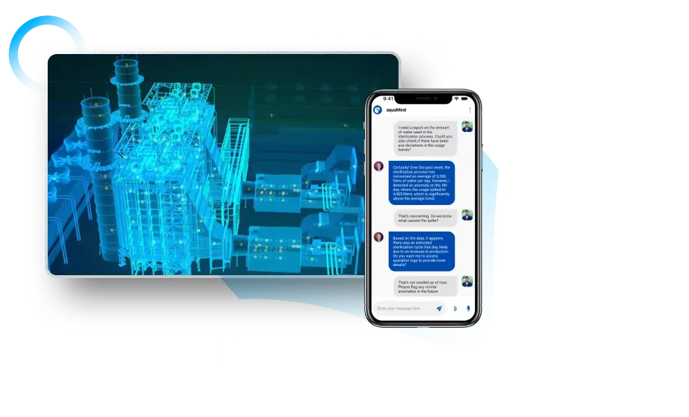
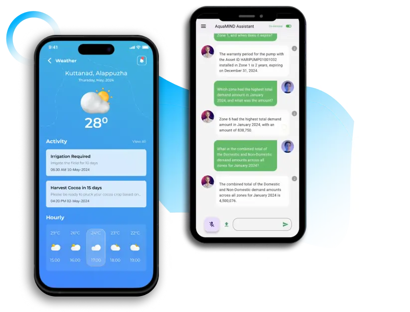
A smart co-pilot with advanced text and vernacular features. GenAI listens to conversations with appropriate permissions and provides inputs like a knowledgeable third party. It harnesses computational power to extract data from dashboards and other resources, delivering precise, targeted information to enhance your decision-making and operational efficiency.
Remote Sensing engine focussing on satellite image processing related to atmosphere and land interactions. It supports agriculture, meteorology, weather forecasting, hydrology, and water resource management applications, providing essential data and insights for informed decision-making in these areas.
Enable various decisions that need huge data inputs, forecasted weather, and various physical characteristics, using artificial intelligence, and machine learning algorithms. For example, sustainable reservoir operations, irrigation planning, water conservation planning, minimizing floods, water cascades, etc.
aquaWISE offers over 20 customised, highly scalable digital solutions, designed to enhance water management. Available as Software as a Service (SaaS) or tailored solutions deployed to customer infrastructures, it ensures flexible and robust water resource management.
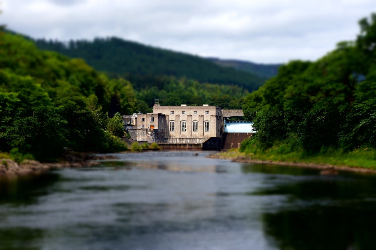
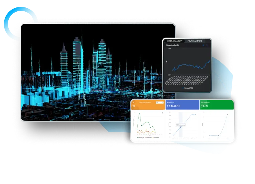
Provides a digital twin to monitor water infrastructure in real-time and
manage supply from source to end-user using IoT and AI.
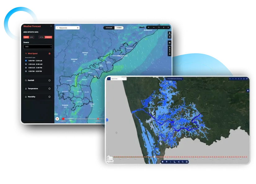
Integrating weather, hydrological, and geospatial data, it offers real-time flood warnings, risk assessments, and strategic planning for comprehensive flood management.
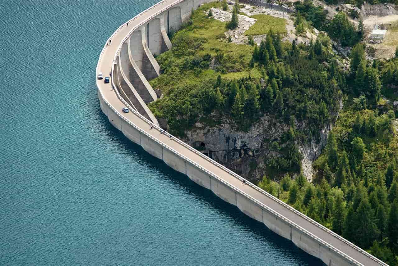
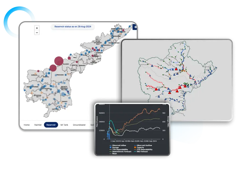
Optimizes rivers and reservoir operations with web-enabled simulations. Minimizes flood risks, maximizes efficiency, and allows collaborative model building with real-time adjustments.
It optimizes irrigation efficiency using IoT sensors, remote sensing, and crop models. It ensures precise water management for maximum productivity and resource optimization.
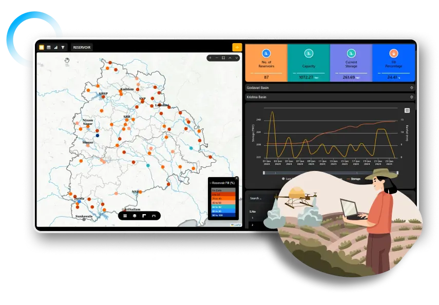
Monitor smaller waterbodies in real-time with IoT, remote sensing, AI/ML, and GIS: track levels, storage, encroachments, and water quality for
comprehensive management.
Strives towards water-neutral facilities by monitoring, managing, recycling, and reusing water and its infrastructure efficiently.

Strives for Business Continuity by establishing water-neutral industries ensuring efficiency, sufficiency, and compliance.
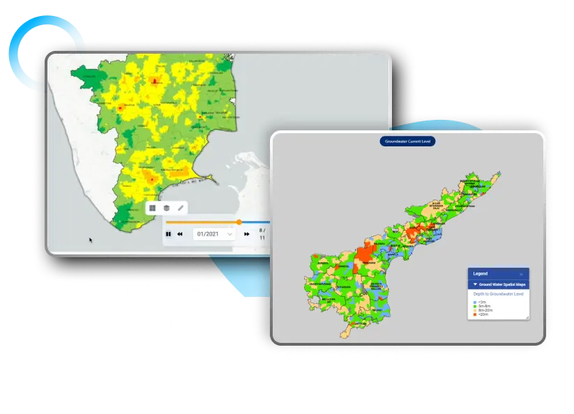
Scientifically assesses watershed health for efficient site selection in conservation and recharge. It creates sustainable plans considering current water needs and climate change.
Comprehensive system for real-time insights into groundwater levels
and recharge rates, identifying stressed areas and aiding long-term water
security with IoT data integration.
GenAI-based smart co-pilot for real-time weather and water insights. Provides alerts, updates in regional languages, human-like interactions, meeting transcriptions, and reports.
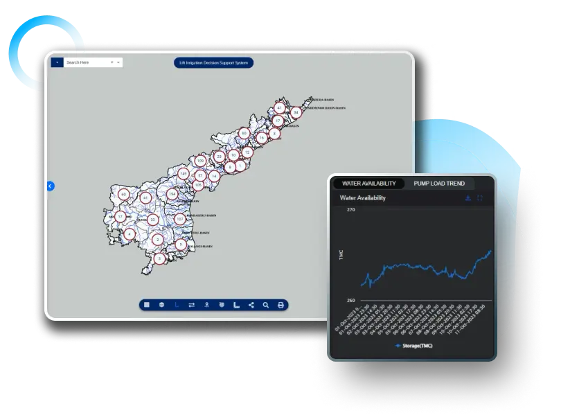
It optimizes water-lifting infrastructure with real-time data and predictive models. It offers actionable advisories for minimal power use, reduced
costs, and consistent water supply.
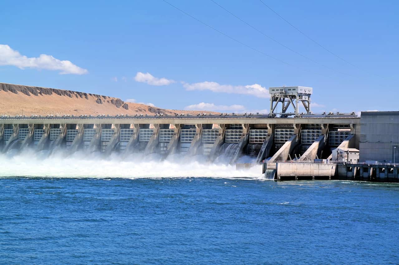
Optimizes hydropower operations for better performance and profitability, ensuring sustainable energy. Manages power networks, addresses climate impacts, and meets compliance requirements.
Evaluates and ranks water governance practices, measuring policy adoption, resource use, and compliance. Fosters competition, driving best practices and evidence-based policies.
Optimizes water infrastructure performance using modern technology. Manages pumps, floodgates, treatment plants, and pipelines, reducing downtime and extending asset life.
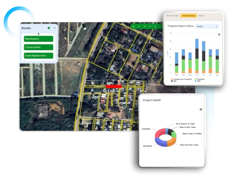
Unified platform for real-time monitoring of water projects. It also integrates data from mobile apps, satellites, and drones for tracking, management, and decision-making.
It is an advanced water management system that evaluates the impact of asset changes on existing infrastructure, facilitating the design of sustainable water systems.
Enables large-scale remote data collection with geo-tagging, geo-fencing, and crowdsourcing. It supports mapping, data validation, and community insights for informed decisions.
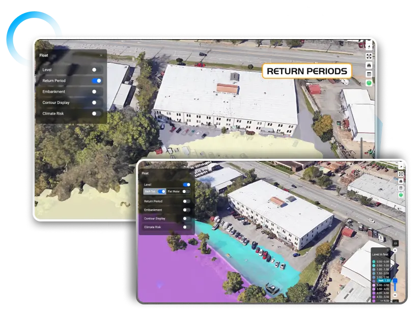
Assess flood risks with cloud-based instant scenarios and return periods. Its 3D visualization provides insights for informed flood risk management, reducing threats and costs.
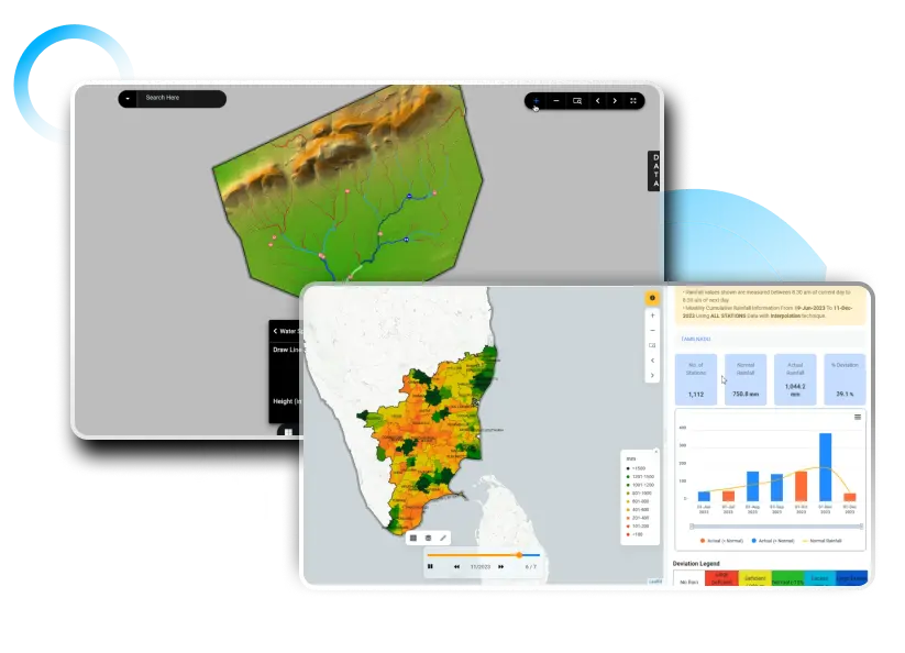
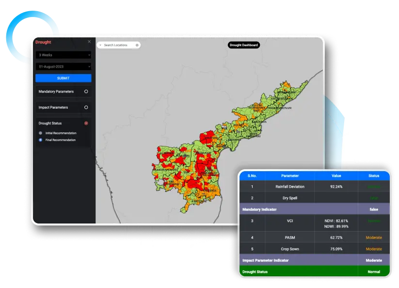
A drought forecasting solution integrating hydrological, meteorological, and remote sensing data. Aids in water planning, risk assessment, crop insurance, and mitigation efforts.
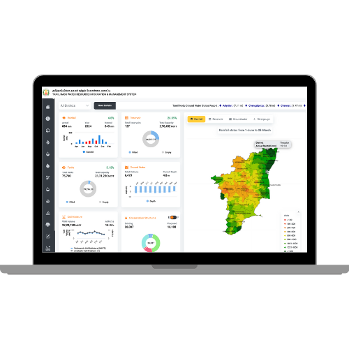
Web-enabled solution for real-time monitoring, visualization, & management of water resources at all levels alongside tracking water life cycle for strategic planning
Collects and analyzes real-time data from various water sources, ensuring comprehensive monitoring and timely decision-making.
Transforms raw data into actionable insights, enabling informed decisions for water resource management through advanced analytics.
Offers easy navigation and data visualization through various platforms, including GIS, mobile apps, and a voice-enabled Co-Pilot, streamlining user interaction and decision-making.
Integrates scientific models and predictive analytics for robust forecasting and scenario planning, helping users anticipate future trends and optimize resource allocation.
Seamlessly integrates with existing systems and can be scaled to accommodate growing data needs without compromising performance.
Implements advanced encryption and data protection strategies to secure sensitive information and protect against unauthorised access.
Discover how Agriculture DPI and AI deliver verifiable, high-precision services for crop optimization. Essential

Explore how cities can move from reactive flood management to proactive one by leveraging
Discover how APAIMS 2.0, powered by VISTAAR and Vassar Labs, is transforming agriculture with

Discover how climate tech startups are using AI, IoT, and satellite analytics to power
Discover how AI-driven piped irrigation systems can reduce water waste, improve agricultural efficiency, and
Explore Climate technology solutions with Vassar Labs – Pioneers in technology platforms for efficient water management, precision agriculture, smart city services, energy and disaster


Automated page speed optimizations for fast site performance