


APWRIMS Harnessing Cyclone Montha Preparedness- Bridging Forecasting, Risk Mitigation and Field Operations
Discover how APWRIMS delivered real-time water management, and coordinated response during Cyclone Montha to
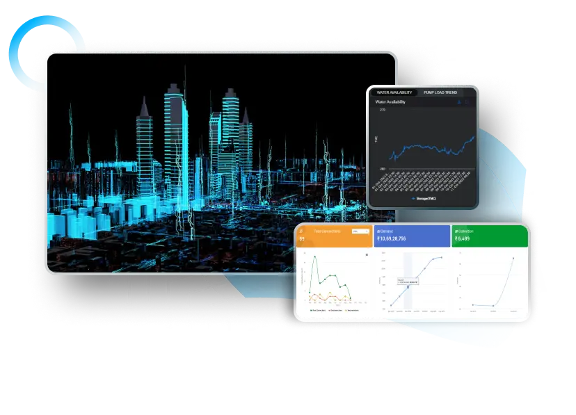


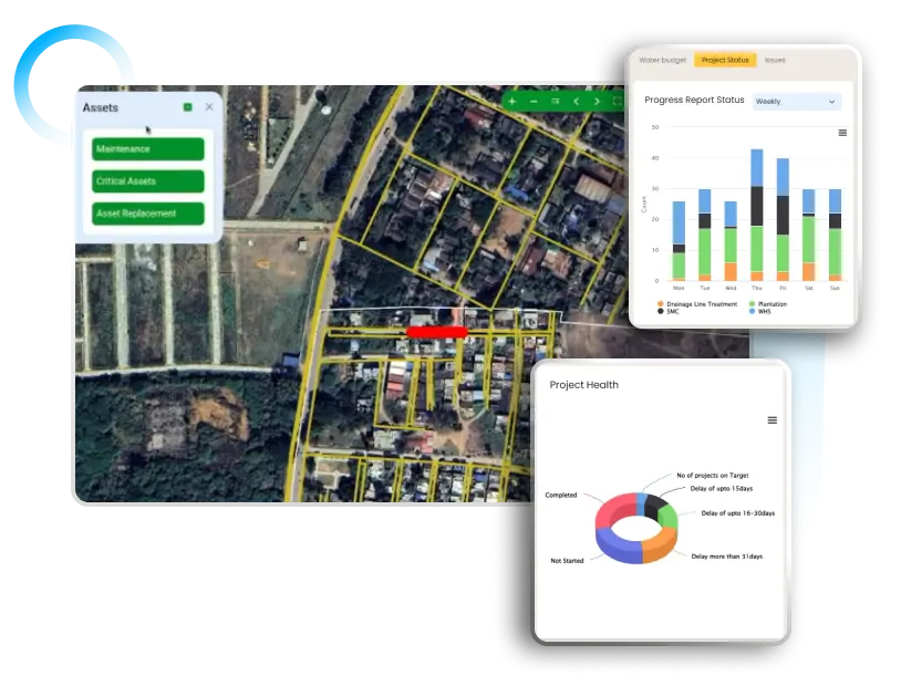
Discover how APWRIMS delivered real-time water management, and coordinated response during Cyclone Montha to

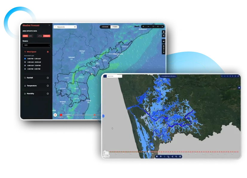
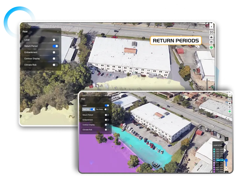
Discover how AWARE 2.0, Andhra Pradesh’s AI-powered early warning system by Vassar Labs, transformed

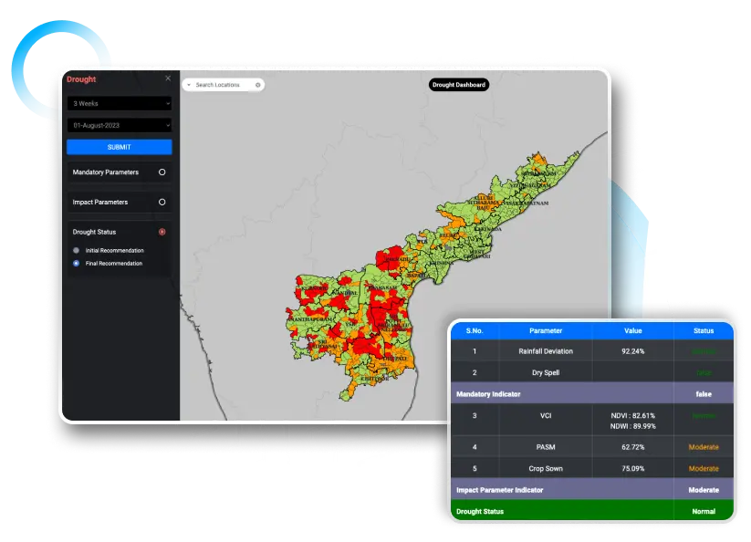
Explore how digital tools enabled faster, transparent, and data-driven agricultural disaster response in Andhra

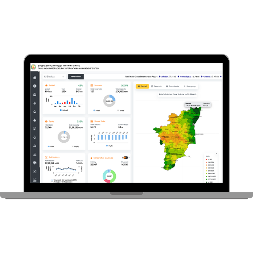
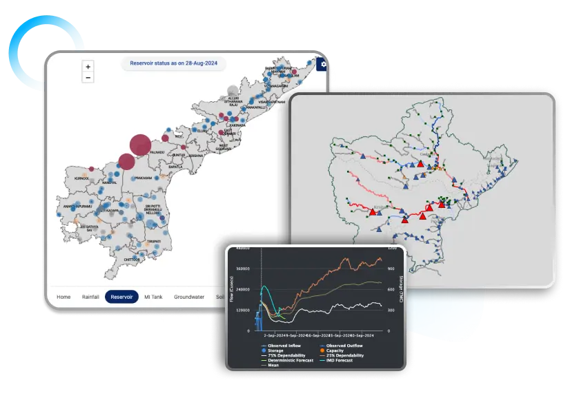
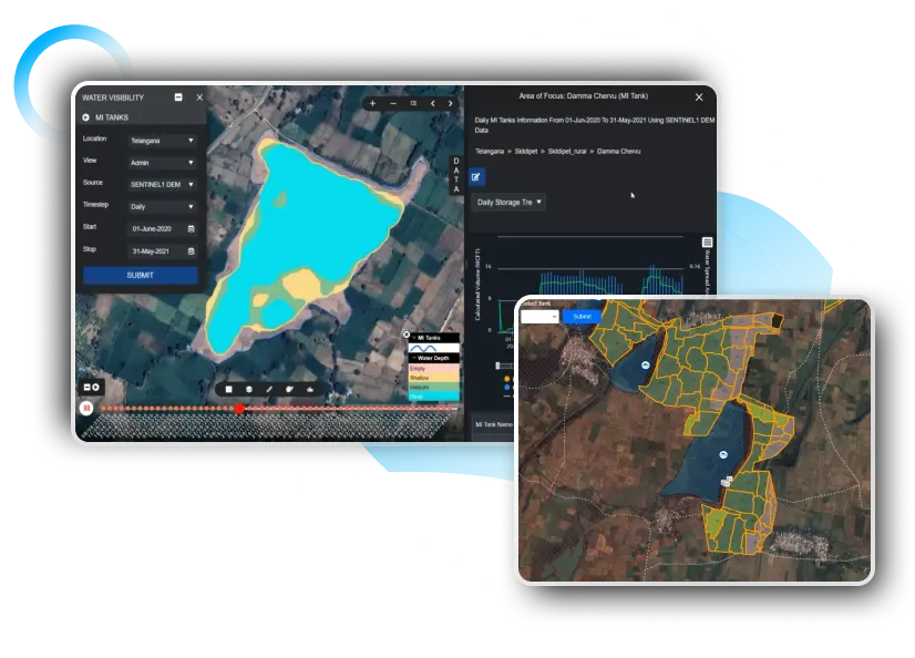
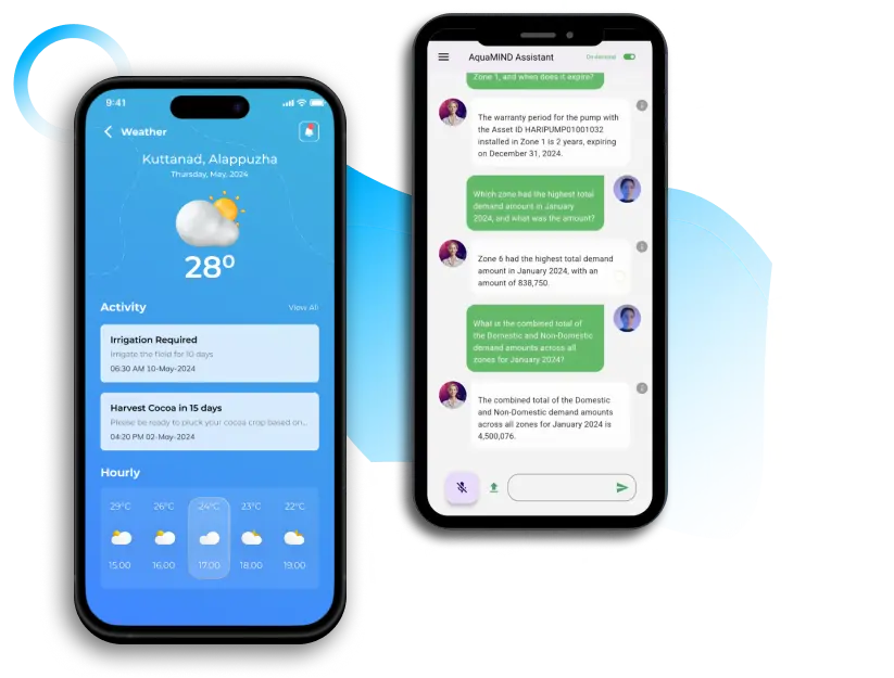
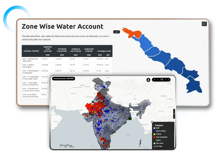
Discover how Digital Public Infrastructure (DPI) transforms water governance through AI-powered platforms like aquaWISE,

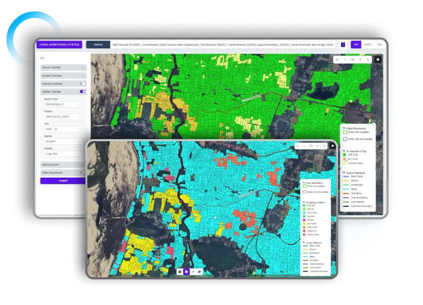
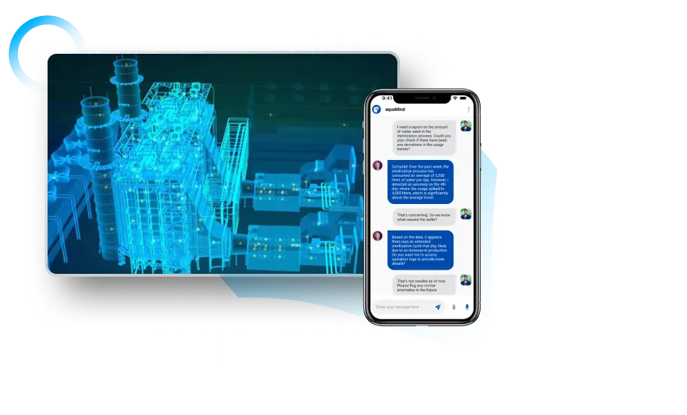
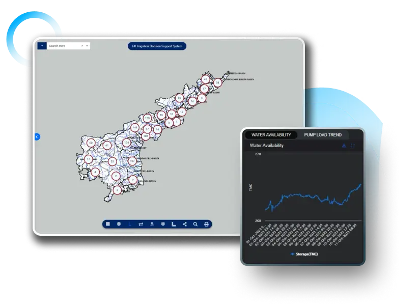
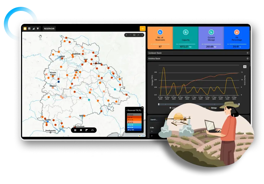
Discover how AI-powered irrigation models reduce water wastage, improve crop health, and strengthen climate