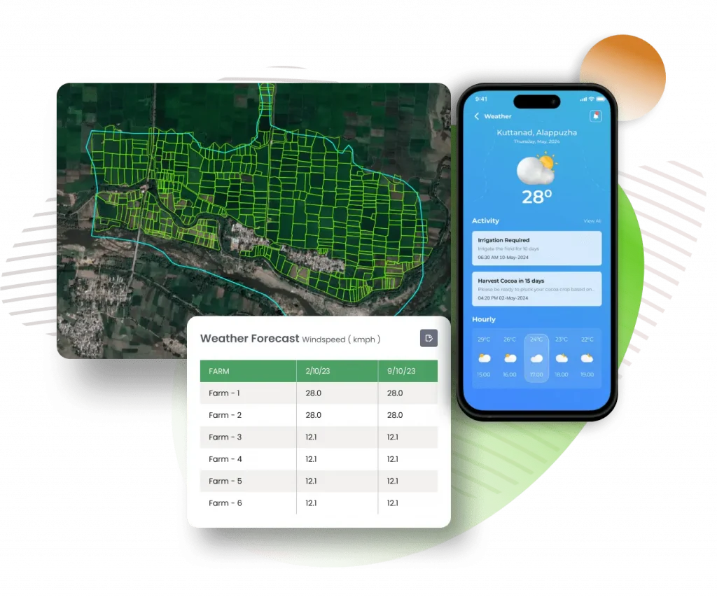
Digitize farm boundaries and enhance farm intelligence, with visibility on expected yield and weather updates from Individual field level to country level data.
fieldWISE, is a unified agriculture platform with a range of products that support data-driven decisions to enhance field productivity amidst challenges posed by climate change
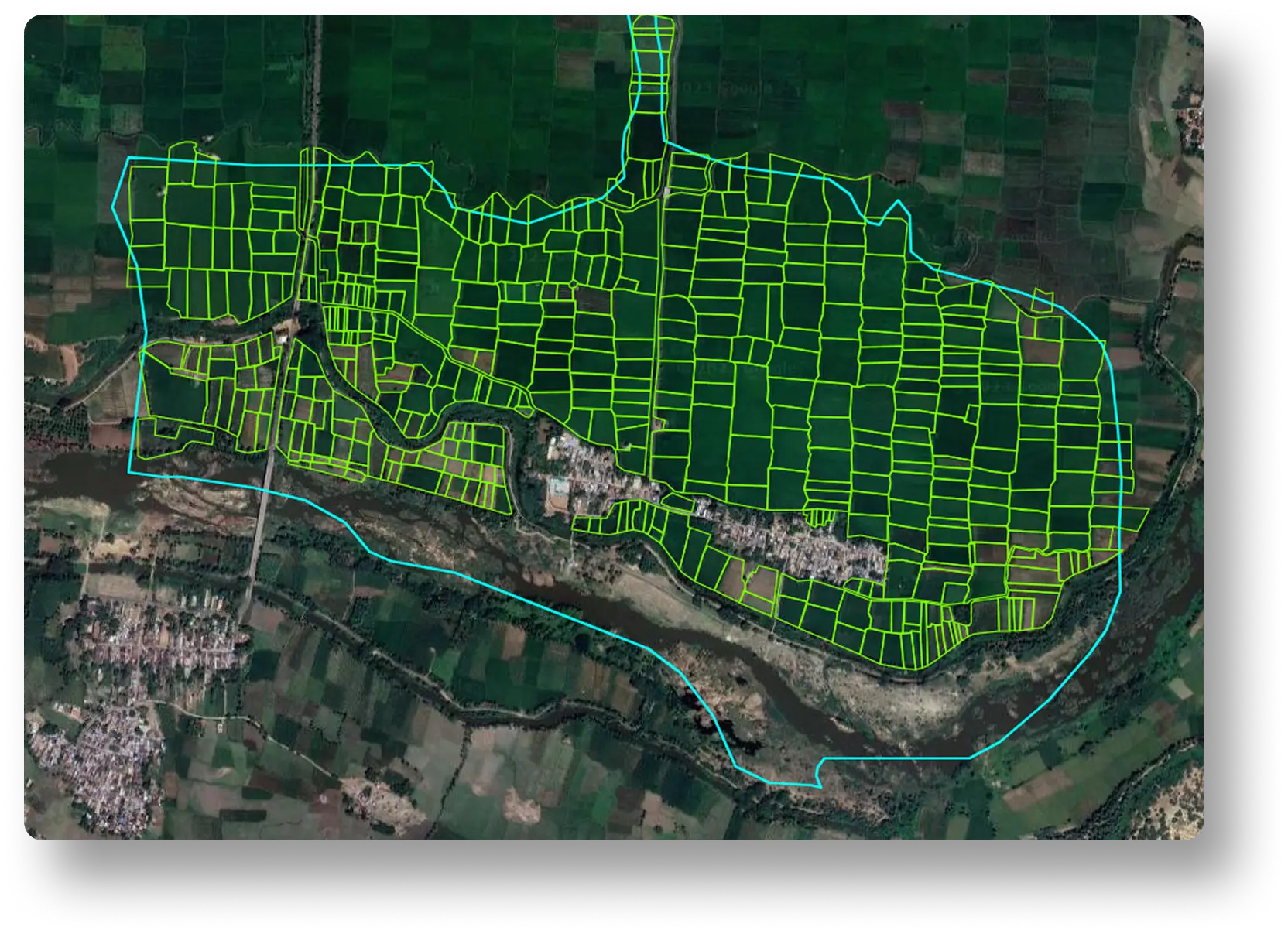
Map Your Field
Digitally map farm boundaries of farms up to 0.5 hectares in size using AI and satellite imagery.
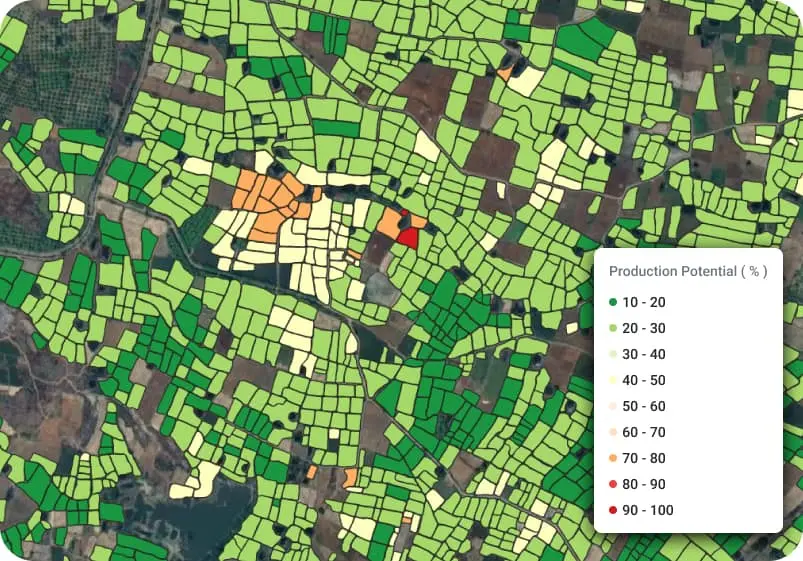
Know Your Yield
Harness the power of AI/ML algorithms to receive the potential yield of your farm based on soil type, crop selection, weather and historic data.
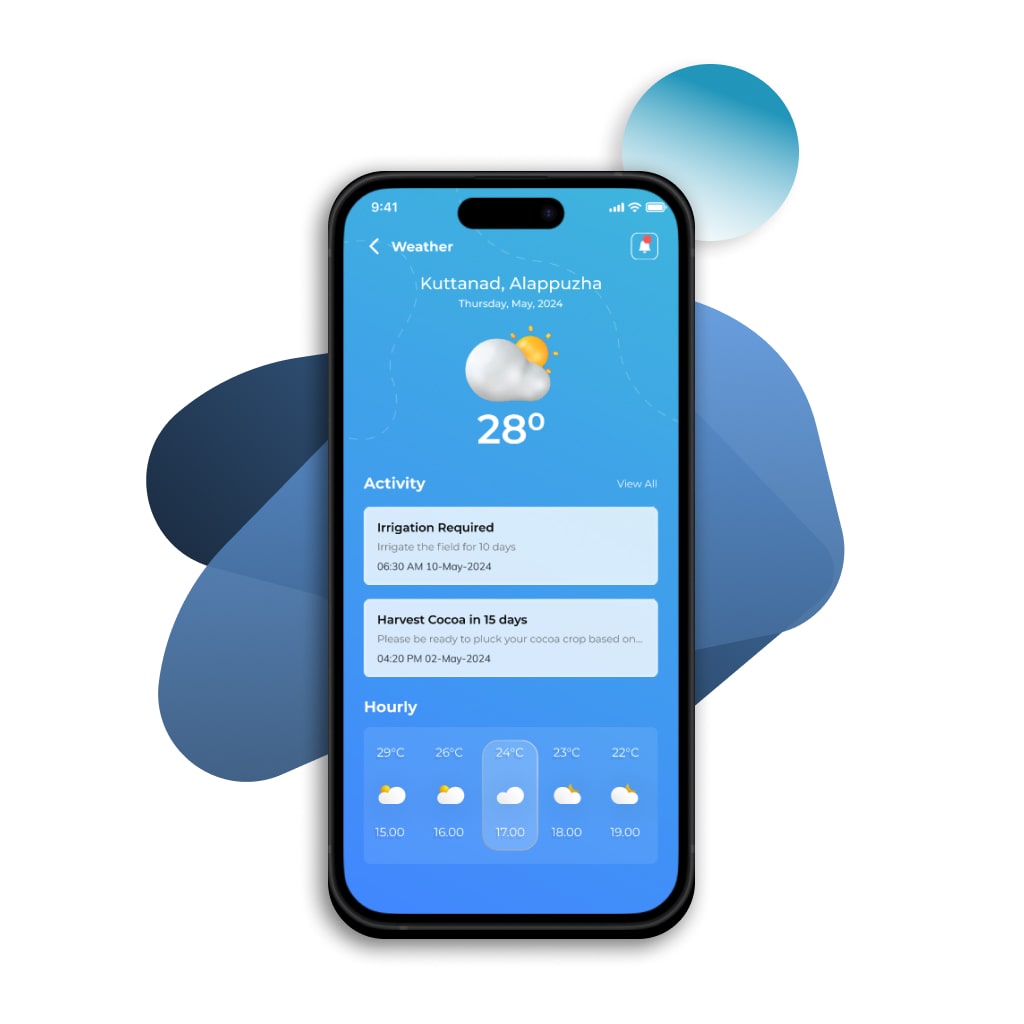
Know Weather Updates
Get Real-time Weather update Service on your designated fields to help you be better prepared.
TRANSFORM YOUR FARMING PRACTICES: DIGITIZE YOUR FIELDS TODAY