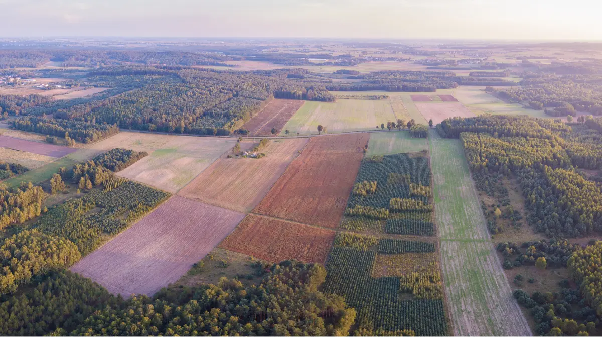
Integrate innovative technologies to improve urban developemnt and sustainability
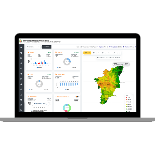
Digital Water Monitoring and Management System, for better Monitoring, Planning and Management of Water
Streamline digital workflows into a single window platform to optimize municipal services and urban infrastructure. Further, take data driven decisions and improve city administrations
Enable various decisions that need huge data inputs, forecasted weather, and various physical characteristics, using artificial intelligence, and machine learning algorithms. For example, sustainable reservoir operations, irrigation planning, water conservation planning, minimizing floods, water cascades, etc.
Assess land use change detection with combination of AI/ML and GIS to classify the land, further monitor changes and review encroachments
Integrate Digital twin of water supply & drainage networks to leverage monitoring of drinking water distribution. Get predictive analytics on water demand/supply, drainage water and assessments.
Overlay analysis to combine layers that share a geographic extent. Access the Near Me feature which will empower urban planners with enhanced visibility into data.
Map house level demands to understand payments of property taxes. Also, unify visibility using GIS to leverage insights on payments
Classify tree types, identify colors, and recognize the stage of flowers using AI/ML. Further, get insights on leaf texture, tree life stage and canopy size.
Leverage plantation survival monitoring, identify small, medium and large tree cover with decision support to analyse green cover index
Monitor construction area, height and offsets for building compliance. Integrate permission system and compliance management for issuing occupancy certificate
Facilitate road construction monitoring, get encroachment alerts and detect road surface anomalies in real-time. Further, enhance road safety and infrastructure lifespan
Understand performance of urban waterbodies with respect to their storage capacity and current storage Health assessment of the waterbodies, as well as alerts on encroachments and water quality
Monitor unauthorized garbage dumps get timeline comparisons on garbage cleaning and periodical monitoring of hot spots
Harness efficient planning and management with Disaster Early Warning system. Get alerts on urban floods on an area or individual property. Simulate inundation in 3D to understand impacts.
Rapid and scalable deployment for immediate impact, scalableright from individual household level to block, ccounty, state and country level.
Easily customisable platform requiring no coding knowledge. Easy one click integrations and plug and play modules.
Our platform offers a seamless integration of diverse data sources, enabling a unified environment where information from IoT sensors, satellite imagery, SCADA systems, and more can be harmoniously combined.
Harnessing the power of cloud technology for efficient and flexible water management.
Empowering clients with ease in capacity building to ensure smooth adoption and utilization.
A smart land use change detection system for identifying unauthrorize land use and raise alerts as per service level agreements
State scale digital municipal administration platform for efficient smart city management
Integration of Digital Water Management platform at state scale for urban water & utility management

At Vassar Labs we make innovation fall into action and create solutions that matter to people. We are passionately working towards a sustainable future by harnessing smart technologies to build climate resilient solutions for water, agriculture, power, land and disaster management.
Copyright © 2024 Vassar Labs, All rights reserved.