Join the forefront of water innovation with aquaWISE. Our platform integrates advanced analytics and digital twin technology to optimize water distribution, mitigate risks, and ensure sustainable usage.
Digital Water Monitoring and Management System, for better Monitoring, Planning and Management of Water
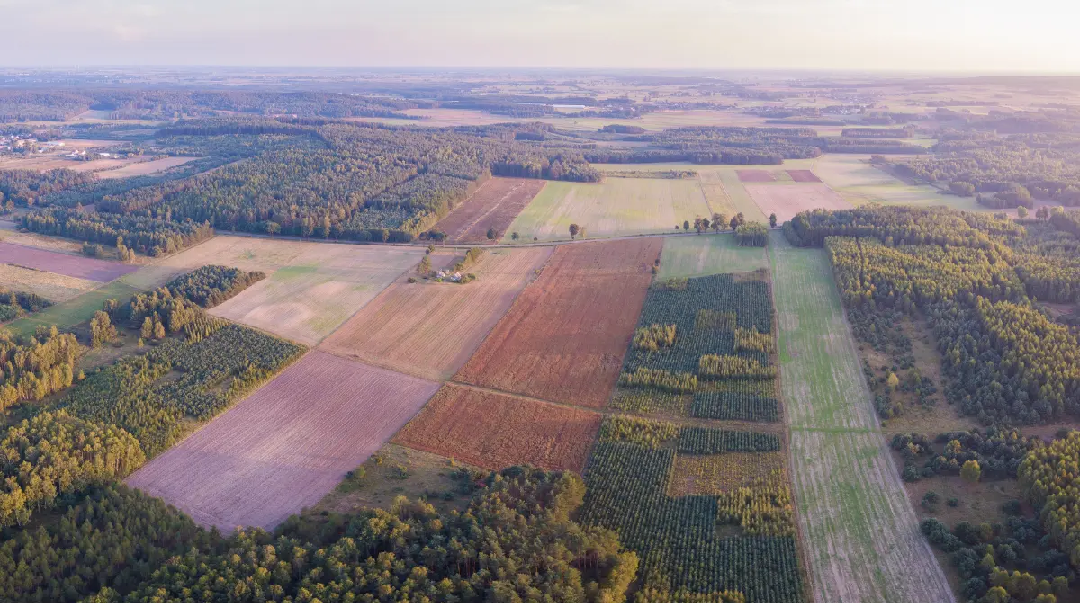
Land is a dynamic asset and its usage keeps changing in accordance to human activities, constructions, agricultural practices, climate related changes like flood, drought, cyclones etc.
The Land Use Intelligence System utilizes near real-time monitoring, AI/ML, and remote sensing for automated identification processes. It serves diverse purposes such as assessing land suitability, monitoring unauthorized land use, tracking infrastructure projects, and analyzing urban areas, sensitive zones, wetlands, forests, habitats, geological patterns, river shores, and more…
Real-time insights for diverse needs, from urban planning to biodiversity conservation, and defence intelligence - empowering informed decision-making and sustainable development.
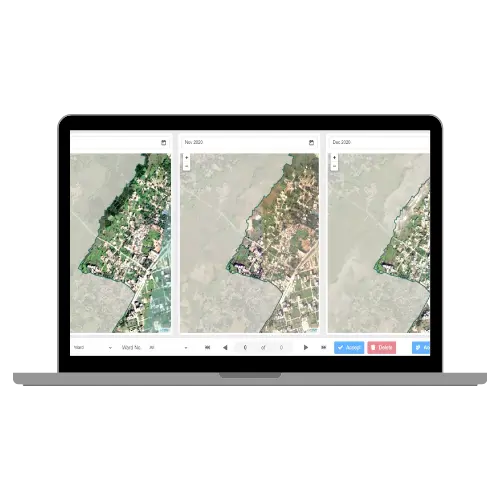
Assess land use change with combination of AI/ML and GIS to classify the land, further monitor changes and review encroachments
Detect unauthorized land use using land cover data, validate alerts with geo-tagged images for sustainable development.
Monitor road, railway, and bridge construction progress, receive alerts for encroachments, and automate site inspections.
Aautomated flow management systems assesses schemes to optimize transfers.
Real-time forest health analysis, deforestation mapping and natural forest monitoring along with forest fire monitoring and damage analysis.
Monitor waterbodies with respect to their storage capacity and current storage, health assessment of the waterbodies, as well as get alerts on encroachments
Monitor utility networks in near realtime, get early identification of changes and alerts on unauthorized activities along with historical trends to prevent 3rd party damage.
Track unauthorized activities in areas of mining and defense spaces. Monitor borders, slope deformation, terrain changes, land use changes etc.
Rapid and scalable deployment for immediate impact, scalableright from individual household level to block, ccounty, state and country level.
Easily customisable platform requiring no coding knowledge. Easy one click integrations and plug and play modules.
Our platform offers a seamless integration of diverse data sources, enabling a unified environment where information from IoT sensors, satellite imagery, SCADA systems, and more can be harmoniously combined.
Harnessing the power of cloud technology for efficient and flexible water management.
Empowering clients with ease in capacity building to ensure smooth adoption and utilization.
A smart land use change detection system for identifying unauthrorize land use and raise alerts as per service level agreements.
State scale digital municipal administration platform for efficient smart city management.
At Vassar Labs we make innovation fall into action and create solutions that matter to people. We are passionately working towards a sustainable future by harnessing smart technologies to build climate resilient solutions for water, agriculture, power, land and disaster management.
Copyright © 2024 Vassar Labs, All rights reserved.